Southern Alberta Trail
Mapping Project
Map Design Changes Starting with
Version 1.18
In versions of the
maps from 1.14 to
1.17, road and waterway details were provided in a background map that
could
only be seen in Mapsource. This was very
handy for planning, but allowed each user to choose their own
background map on
the GPS. Unfortunately, Garmin made a
change to Mapsource in version 6.16.1 that prevented the detailed trail
maps
from being visible in Mapsource. This
problem also has affected all versions of Basecamp.
It seems that Garmin will not be solving this
bug in the near future. In order to
allow for the background maps, we have developed a workaround.
Starting in versions
1.18, the
background map is now being installed as a detailed map similar to the
trail
maps. It shows within Mapsource and
Basecamp behind the Trail Maps.
Most users will not
want to have
these background maps on their GPS as it will cover up whatever road
maps that
they want to use. It is important that
everyone be careful not to install the background maps with the
detailed maps. The background map is
called “Mapsource
Only”. Please check the map tab
and delete this map if it is shown (and you do not want it) before
sending to
the GPS.
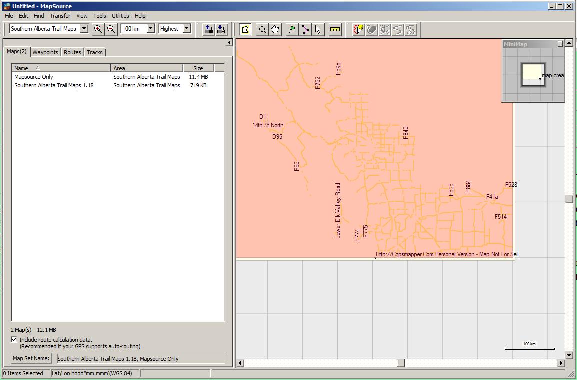
The screenshot below
shows the map
selection with only the Trail Maps and will be preferred by most users. Note the “Include route calculation
data” checkbox. Only check this if
autorouting is desired.

The screenshot below
shows the
background map selected as well. If you
do not want the background map on the GPS, selected that map on the map
sidebar
and delete it.

If you grab too much, the map is darker and the free storage drops a lot!, like this! Clear like mud?
