Southern Alberta Trail
Mapping Project
|
F.A.Q. |
||
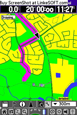
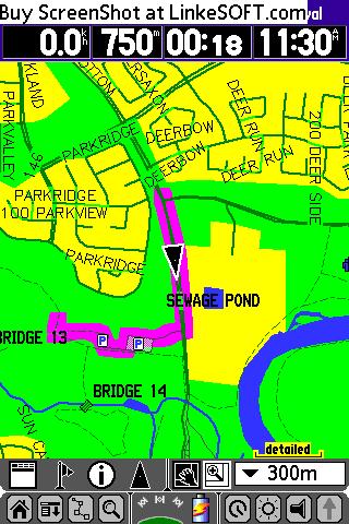
1) How do I make a good track log?
a.
Before
starting your
trip, go into the Setup menu for your GPSr. If it has options for
adjusting
the recording frequency or quality set it to the best available.
Usually
this is shown as "most often".
- Turn on the GPSr and
allow it a clear view of the sky for a good 15 minutes before starting
the trip. This allows the unit to connect with as many satellites
as possible. This increases accuracy and helps to maintain
satellite lock.
- Clear the active track
log (if you don't want it for something else). This makes the
upload shorter and it is less work in figuring out what part of the
track is the trail in question.
- Place the GPSr in a good
location to receive the satellite signals. Usually on top of your
pack works well. Be aware of where the antenna is located and the
best orientation of the GPSr for signal strength. For instance,
the Etrex style units use a patch antenna. They work best when
oriented horizontally.
- When the trip is over,
the best thing is to turn the unit off until you can off load the
track. If this is not desirable, then save the track to the
unit's memory. It is preferred to upload the "active" track
instead of a "saved" track, if possible, as it will contain more detail.
2)
What do you want me to send you?
- The track log.
Whatever file format is convenient for you is fine with me as I can
convert from most. If you have a choice then
- The name of the trail.
- Any waypoints on the
route, such as parking area, toilets, viewpoints, important route
finding locations or anything else that might seem useful on a map.
3)
What trails do you need?
See
the Trail List section for a list of current
trails in
the mapset. Feel free to send any trail data that you might have
even if
it is shown in the list. If we already have a trail, we will
compare your
data and look for descrepancies that could help to improve the mapset.
We are also pleased to get "routes" of any ascent or descent that you
have done. Any path that is not on a well defined trail is marked
as a
route (Rt) on the maps to let you know that the path is only one
possible way
to the destination.
4)
I've uploaded your maps and I found an error or
would like to see a change made.
Please feel free to
send any
helpful information to our e-mail
address.
This mapping project is for you the map user and anything we can do to
make it
more useful is our goal.
5)
I've installed your maps and I can’t see
anything in Mapsource or Basecamp.
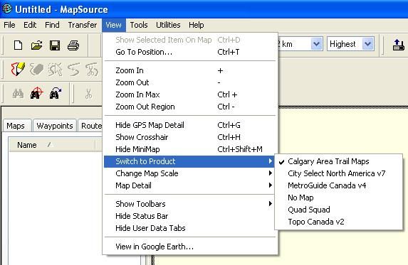
a) First you need to
choose the
mapset. Click on “View” in
the menu bar. Then choose “Switch
to Map Product” and click on “Southern Alberta Trail
Maps”. When chosen, a checkmark
should appear next to the name.
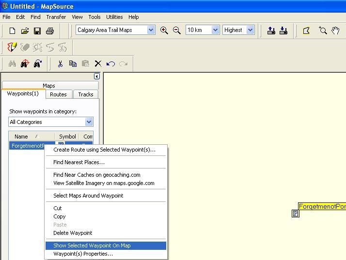
b) Next
you need to be looking at a location on the map that has a trail on it. Open
the test file by clicking on this sentence.
Then center the map on the one waypoint in the file. Click on the “Waypoints” tab is
the side bar. Right click on the
waypoint “Forgetmenotpond” and choose “Show Selected Waypoint
on Map”. The map will then center
on that waypoint.
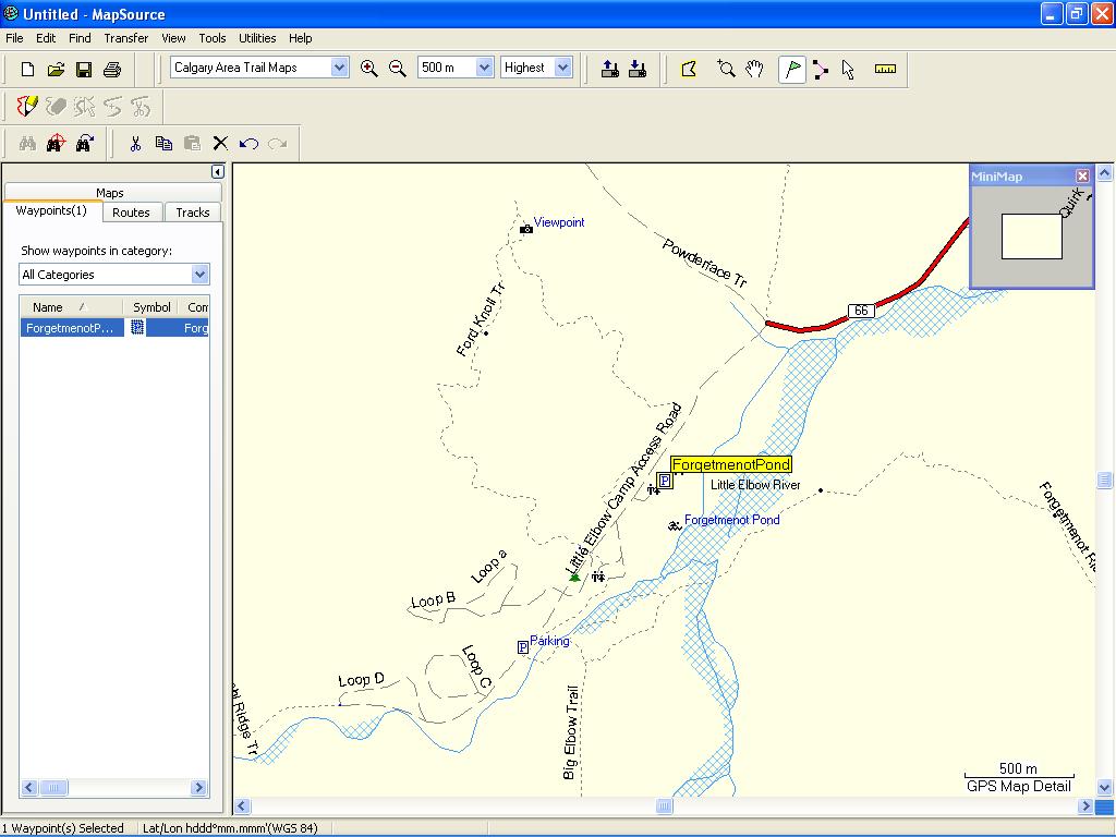
c) Now
zoom in
using the magnifying glass symbol
with the + inside in the upper toolbar until the trails show up.
If you are still not seeing anything, try pressing CRTRL-G.
6)
How do I get these to auto-route?
- On Garmin auto-routing
receivers, the maps are able to auto-route to your destination. As the maps are transparent, normally another
map will be “on” at the same time as the Southern Alberta Trail Maps. When you start a route, the units looks for
the closest road. The routing is then
calculated using the mapset that this road (or trail) belongs to. The routing can NOT use two map sets at the
same time. If your route starts on a
different map set and you want it to change so as to use the Southern
Alberta Trail Maps, choose “recalculate” once you have reached one of
the trails or roads on the Southern Alberta Trail Map Set.
Every time the unit recalculates (manually or automatically)
it will use the closest road or trail to determine which map set to use
for the route.
Example:
I want to go to a spot in
This is not the greatest way to get to that
location. Fortunately I have the Southern
Alberta Trail
maps and can see a nice trail to take me there.
I ignore the route and head towards the trailhead.
Once I get off of the City Select route, the
unit recalculates the route and uses the Southern Alberta Trail Maps
instead as
I have moved onto those maps.
You may need to manually force
the unit to recalculate depending on the situation.
7)
If the road or trail is on both map sets, which
map will the unit use in routing?
The unit should choose the Southern Alberta
Trail Maps in
preference to any other maps as long as they are “normal” and not
“transparent” maps.
8) I keep get route
calculation errors when used with other routable maps.
On the newer style units like the Nuvis and
9) In Mapsource, I
see roads and rivers, but they are not on the GPS.
Starting in version 1.14, we have added roads,
water
features and some points of interest that are ONLY viewable within
Mapsource. These have been provided to
aid in route planning. The data is from
Ibycus’ maps (www.ibycus.com). If you would like this data on your GPS,
please install Ibycus’ maps at the same time as the CAT maps and you
will
see them together.
Starting in version 1.18, this road data is now
on a second
detailed map. If you do not want these
roads on the GPS, make sure NOT to send the map titled “Mapsource
Only” to the GPS and only the “Southern Alberta Trail Maps”. See this page for
more details.
10) The
trails are red in Mapsource but not on my GPS
Starting in version 1.14, TYP customization has
been added
to improve the visibility of trails and unpaved roads.
This customization only works within
Mapsource and on newer style Garmin GPS units.
Older units do not support this and the trails will appear as
they
normally did in the past.
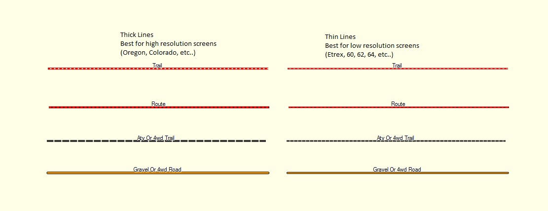
11) What are the different lines for and what is "Thick" and "Thin".
a) The thick lines are a bit wider and work best on the higher resolution units like the Oregon. The thin lines are better for low resolution units like a 64. Use what you feel looks best.
b) There are four main "trail" types used. These give a rough indication of the type of trail, but you should be familiar with the local rules and not take these as gospel.
- Trail - These are meant to show
non-motorized trails. They should be useable by foot and may be
useable by bicycle depending on the local rules. As opposed to
"routes", these should have a defined path.
- Route - A route is a possible path for non-motorized users. It is not defined or set but is a path that someone else has recorded and followed.
- ATV or 4WD trail - This is a
motorized access off highway trail. It may be restricted to ATVs,
Bikes or Trucks or a combination of them depending on the local area
regulations.
- Gravel or 4WD road - This is a motorized access road that is either a gravel road or a 4WD trail.